- Simulation tool for the sustainable implementation of shared mobility services
- 2021 – 2022

Context
Shared car, motorcycle, bicycle, and scooter services have spread across numerous cities in recent years, adding a new mode to the available options to meet citizens’ mobility needs. This initial phase of implementation has been characterised by rapid growth: on one hand, shared mobility operators have prioritised strategies for swift deployments to enhance their visibility in comparison to competitors; on the other hand, authorities responsible for urban mobility planning have reacted to these new services in various ways, adopting diverse stances ranging from implementing specific incentives to outright operational bans.
In the next phase of consolidating shared mobility services, a demand shared by both operators and authorities is analytical tools that facilitate better decision-making. Operators face the challenge of ensuring the financial viability of their business models, necessitating service planning and operation that considers the impact of each decision on demand. Authorities need to integrate these services into their urban sustainability strategies, which requires evaluating the impact that different regulatory frameworks can have on their provision and on the overall transportation system. Both needs converge on a single requirement: having demand predictions and indicators derived from shared mobility services that are sensitive to various configurations, thereby enabling improved planning, management, and evaluation of the service.
The SHAPE project
SHAPE is a research project that developed a simulation platform for shared mobility systems to facilitate the planning and management of these services by operators, as well as the design of regulatory frameworks by authorities. The platform improved and expanded the functionalities of the decision support tool prototype that Nommon developed within the projects DSS4SM and SHAPEMOV to support strategic planning and service management carried out by shared mobility operators.
The SHAPE platform leveraged the growing availability of geolocated data sources and the latest advances in transport modelling techniques to provide indicators based on the prediction of shared mobility demand. The project also aimed to expand the environmental indicators available in the tool, providing support to authorities in one of the most important pillars of transport planning and management: its impact on the environment. The tool added indicators for CO2, NOx, PM pollution, etc., allowing authorities to monitor emissions from shared mobility modes and design regulations that align these modes with the cities’ greenhouse gas reduction goals.
Objectives
The specific objectives of the SHAPE project were:
- Define the needs that transportation authorities and shared mobility operators have in relation to the design (by authorities) and implementation (by operators) of regulatory frameworks, in order to include in the SHAPE platform those indicators, functionalities, and interactions with other tools that are necessary.
- Understand and thoroughly characterise shared mobility user profiles and the usage patterns of these services, including sociodemographic characteristics of users, number of trips per user, travel distance, purpose of trips, etc.
- Formulate, calibrate, and validate demand models for shared mobility systems that allow the simulation of different regulatory scenarios. Calculate the necessary indicators to evaluate the impact of each scenario on urban mobility sustainability and the viability of business models. These models are based on the knowledge of overall mobility patterns and users’ characteristics and usage patterns.
- Develop simulation tools for different deployment strategies, whether for new deployments or modifications (e.g., service area expansions in existing services), or for operation (e.g., fleet management, pricing policies, etc.). These tools include service indicators (optimal fleet size, etc.) and impact indicators on the city (street occupancy, etc.), enhancing and expanding the functionalities existing in the solution prototype developed by Nommon.
- Develop simulation tools to assess the impact on urban mobility sustainability of different regulatory scenarios for shared mobility services, expanding the scope of the prototype developed by Nommon, providing transportation authorities with new environmental indicators, such as CO2, NOx, PM.
- Integrate the simulation tools into a visualisation platform that enhances collaborative decision-making processes in the design of regulatory frameworks by transportation authorities and the adaptation of shared mobility services to these frameworks by operators. Validate the applicability of the platform in real operational environments by these stakeholders.
Results
The primary result of the project has been the development of a decision support tool designed for the planning and management of shared mobility systems for both authorities and operators. These advancements stemming from the SHAPE project have driven the creation of Nommon’s solution WiseRide.
The tool encompasses the following use cases:
- Strategic planning module:
- System expansion: evaluation of expanding the shared mobility system to specific areas of the city.
- Strategic indicators: the platform provides predictions for trips originating in the current service operation area for defined typical days.
- Operation module:
- Demand prediction: allows end users to predict the demand for their shared mobility service for the next seven days.
- Vehicle placement: determines city areas suitable for placing vehicles that are currently out of operation, for instance, those in storage undergoing maintenance.
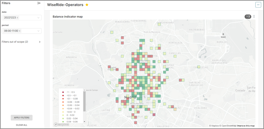
- Vehicle redistribution: provides a set of operational indicators for all zones defined within the city’s geofence where predictions are desired.
- Urban planning module:
- Stranded vehicles: offers a set of indicators that enable cities to predict how many vehicles will accumulate in each of the operation zones at the end of a specified time period.
- Environmental indicators: based on the prediction of demand for each origin-destination pair, available modal split information in the city (mobility reports, surveys of shared mobility users…), and a Life Cycle Assessment (LCA) analysis that determines the environmental impact of different services, the tool provides predictions of equivalent CO2 emissions in each zone.

SHAPE was funded by the European Regional Development Fund, within the operational program ERDF, and supported by Red.es, under the 2020 grant call for technological development based on artificial intelligence and other enabling digital technologies.